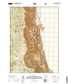
2020 Map of Fremont Point
USGS Topo · Published 2020About this map
Winter Ridge dominates this portion of the Fremont National Forest, forming a dramatic escarpment that drops toward the western shores of Summer Lake. The terrain is defined by its sharp vertical transitions, from the high elevation at Fremont Point and Brattain Hill down to the low-lying basins of Big Flat and Bennett Flat. This landscape is navigated by a network of forest roads and the Southern Oregon Intertie Trail, which snakes along the ridge line. Water sources are scarce but localized, featuring high-altitude catchments like Foster Reservoir and Little Ross Reservoir, along with smaller features such as Squirrel Spring and Benny Cr. The geology of the ridge is highlighted by distinctive landforms like The Punchbowl and the strategic Hunter Hill Pass, providing a clear record of the area's topographical character in the early 21st century.
Find a feature on this map
26 named features on this map. Tap any name to fly to it.
Don’t see what you’re looking for? This feature index may not catch every label — zoom into the map to look around manually.
Map Details
Editions of this 2020 Fremont Point Map
This is the sole edition of this map. No revisions or reprints were ever made.
Other maps of this area

1955 · Klamath Falls
USGS Topo · 1:250,000

1958 · Klamath Falls
USGS Topo · 1:250,000

1966 · Summer Lake
USGS Topo · 1:24,000

1966 · Shake Butte
USGS Topo · 1:24,000

1966 · Slide Mtn
USGS Topo · 1:24,000

1966 · Harvey Creek
USGS Topo · 1:24,000

1966 · Fremont Point
USGS Topo · 1:24,000

1966 · Pole Butte
USGS Topo · 1:24,000

1966 · Foster Butte
USGS Topo · 1:24,000

1974 · Lake Abert
USGS Topo · 1:100,000