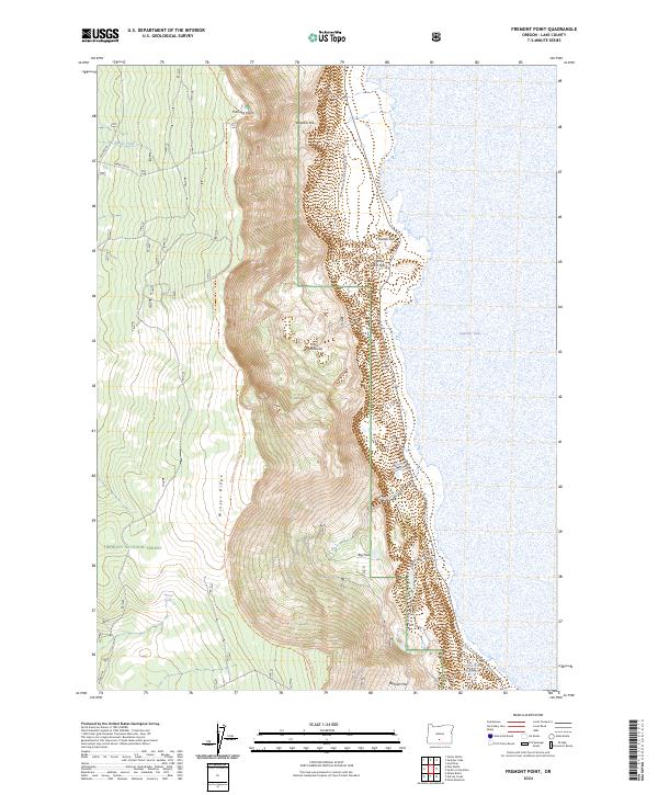
2024 Map of Fremont Point
USGS Topo · Published 2024About this map
Winter Rim towers over the western edge of Summer Lake, creating a dramatic transition in the high desert landscape of Lake County. This 2024 map documents the steep, craggy face of Winter Ridge within the Fremont National Forest, where topography rises sharply from the basin floor. Key vantage points like Fremont Point and Brattain Hill look out over the lake and the intermittent wetlands near the shoreline. The drainage network is defined by features such as Foster Creek feeding into the Foster Reservoir, while the Southern Oregon Intertie Trl follows the high ground of the ridge. Water management for the arid region is evident in the inclusion of the Little Ross Reservoir and Squirrel Spring, highlighting the critical nature of these resources for local ranching and wildlife.
Find a feature on this map
23 named features on this map. Tap any name to fly to it.
Don’t see what you’re looking for? This feature index may not catch every label — zoom into the map to look around manually.
Map Details
Editions of this 2024 Fremont Point Map
This is the sole edition of this map. No revisions or reprints were ever made.
Other maps of this area

1955 · Klamath Falls
USGS Topo · 1:250,000

1958 · Klamath Falls
USGS Topo · 1:250,000

1966 · Summer Lake
USGS Topo · 1:24,000

1966 · Shake Butte
USGS Topo · 1:24,000

1966 · Slide Mtn
USGS Topo · 1:24,000

1966 · Harvey Creek
USGS Topo · 1:24,000

1966 · Fremont Point
USGS Topo · 1:24,000

1966 · Pole Butte
USGS Topo · 1:24,000

1966 · Foster Butte
USGS Topo · 1:24,000

1974 · Lake Abert
USGS Topo · 1:100,000