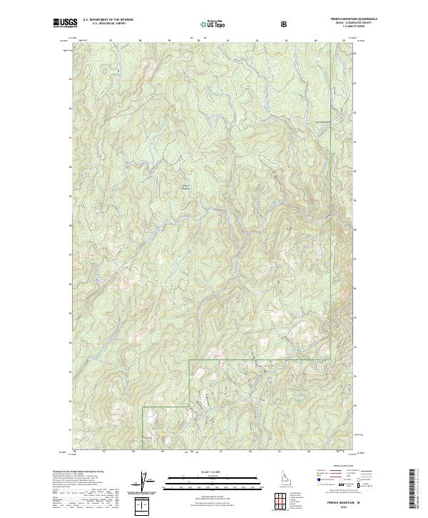
2024 Map of French Mountain
USGS Topo · Published 2024About this map
Clearwater National Forest encompasses this high-elevation landscape, where the summit of French Mtn stands as a prominent landmark. The area is defined by a dense network of watercourses and gulches, including French Creek and Elk Creek, which feed into the wider drainage systems of the region. Historically, the presence of Arnett Meadows and Oxford Meadows suggest points of interest for early travelers or stockmen through these timbered reaches. Transportation through the area relies on French Mountain Rd and Co Rd 250, which navigate the steep drainage divides. A legacy of prospecting is hinted at by features such as China Gulch, Business Gulch, and Fidelity Gulch, names that often reflect the era of mineral exploration in the Idaho backcountry.
Find a feature on this map
34 named features on this map. Tap any name to fly to it.
Don’t see what you’re looking for? This feature index may not catch every label — zoom into the map to look around manually.
Map Details
Editions of this 2024 French Mountain Map
This is the sole edition of this map. No revisions or reprints were ever made.
Other maps of this area

1923 · Washington Creek
USGS Topo · 1:125,000

1924 · Weippe
USGS Topo · 1:125,000

1938 · Headquarters
USGS Topo · 1:48,000

1944 · Headquarters
USGS Topo · 1:62,500

1956 · Hamilton
USGS Topo · 1:250,000

1959 · Hamilton
USGS Topo · 1:250,000

1960 · Hamilton
USGS Topo · 1:250,000

1963 · Clarke Mtn
USGS Topo · 1:24,000

1964 · Hamilton
USGS Topo · 1:250,000
1965 · Larch Butte
USGS Topo · 1:24,000