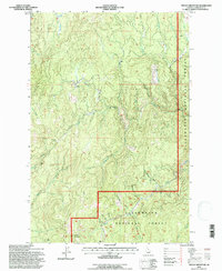
1994 Map of French Mountain
USGS Topo · Published 1997About this map
French Mountain anchors this rugged landscape in the heart of the Clearwater National Forest as it was documented in the mid-1990s. The terrain is defined by complex drainage systems and ridges, notably the Shanghai Divide which separates the Shanghai Creek watershed from the surrounding mountains. Mining history is evident in the northern reaches, where the Oxford Mine and Campbell Mine are located near Oxford Meadows.
Find a feature on this map
25 named features on this map. Tap any name to fly to it.
Don’t see what you’re looking for? This feature index may not catch every label — zoom into the map to look around manually.
Map Details
Editions of this 1994 French Mountain Map
This is the sole edition of this map. No revisions or reprints were ever made.
Other maps of this area

1923 · Washington Creek
USGS Topo · 1:125,000

1924 · Weippe
USGS Topo · 1:125,000

1938 · Headquarters
USGS Topo · 1:48,000

1944 · Headquarters
USGS Topo · 1:62,500

1956 · Hamilton
USGS Topo · 1:250,000

1959 · Hamilton
USGS Topo · 1:250,000

1960 · Hamilton
USGS Topo · 1:250,000

1963 · Clarke Mtn
USGS Topo · 1:24,000

1964 · Hamilton
USGS Topo · 1:250,000
1965 · Larch Butte
USGS Topo · 1:24,000