
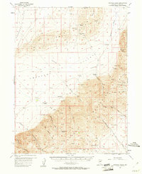
1957 Map of Frenchie Creek
USGS Topo · Published 1958About this map
The Cortenz Mountains dominate the southern half of this landscape, giving way to the broad alluvial expanses of Crescent Valley and Frenchie Flat. In the late 1950s, this area of Nevada served as a rugged ranching and mining frontier. Remote homesteads like Frenchie Ranch, Duff Ranch, and Dewey Dann Ranch are established along the transition from the high peaks to the flats, where water is a critical resource.
Find a feature on this map
41 named features on this map. Tap any name to fly to it.
Don’t see what you’re looking for? This feature index may not catch every label — zoom into the map to look around manually.
Map Details
Editions of this 1957 Frenchie Creek Map
2 editions found
Other maps of this area

1937 · Mineral Hill
USGS Topo · 1:48,000

1938 · Cortez
USGS Topo · 1:48,000

1943 · Mineral Hill
USGS Topo · 1:62,500

1944 · Cortez
USGS Topo · 1:62,500

1949 · Crescent Valley
USGS Topo · 1:62,500

1950 · Crescent Valley
USGS Topo · 1:62,500

1952 · Pine Valley
USGS Topo · 1:62,500

1952 · Carlin
USGS Topo · 1:62,500

1955 · Winnemucca
USGS Topo · 1:250,000

1957 · Dunphy
USGS Topo · 1:62,500