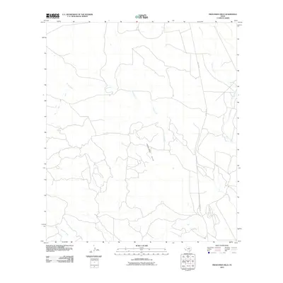
2010 Map of Frenchman Hills
USGS Topo · Published 2010About this map
Frenchman Hills dominate the topography of this Presidio County landscape, where an intricate network of desert drainages carves through the terrain. The hydrological pattern is defined by the significant reaches of Perdiz Creek and Alamito Creek, which converge and wind through the eastern and central portions of the quadrangle. In the southwestern corner, the headwaters of Matonoso Creek emerge, further illustrating the complex watershed system of this West Texas region. Human infrastructure is sparse, concentrated primarily along the corridor of Ranch Rd 169, which provides the main north-south transit through the area. A single Oil Well marked in the northwest suggests the localized industrial activity that occasionally punctuates this ranching and drainage-dominated landscape during the early 21st century.
Find a feature on this map
7 named features on this map. Tap any name to fly to it.
Don’t see what you’re looking for? This feature index may not catch every label — zoom into the map to look around manually.
Map Details
Editions of this 2010 Frenchman Hills Map
This is the sole edition of this map. No revisions or reprints were ever made.
Other maps of this area

1895 · Marfa
USGS Topo · 1:125,000

1895 · Alpine
USGS Topo · 1:125,000

1896 · Shafter
USGS Topo · 1:125,000

1918 · Jordan Gap
USGS Topo · 1:62,500

1930 · Jordan Gap
USGS Topo · 1:62,500

1954 · Fort Stockton
USGS Topo · 1:250,000

1958 · Fort Stockton
USGS Topo · 1:250,000

1959 · Emory Peak
USGS Topo · 1:250,000

1959 · Presidio
USGS Topo · 1:250,000

1959 · Marfa
USGS Topo · 1:250,000