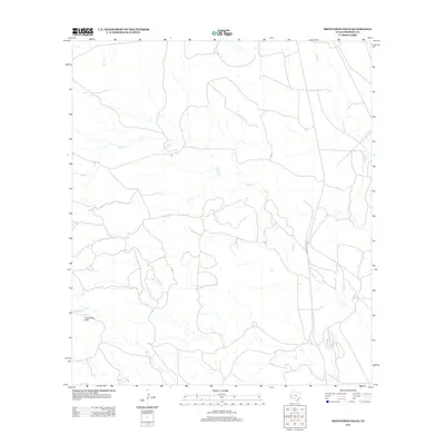
2012 Map of Frenchman Hills
USGS Topo · Published 2012About this map
The Frenchman Hills define the southwestern elevation of this Presidio County landscape, where an intricate network of intermittent drainages carves through the high desert. Ranch Road 169 serves as the primary corridor through this sparsely populated territory, following the north-south alignment of the drainage basins. Water, though often seasonal, dictates the geography as Perdiz Cr and Alamito Cr weave across the eastern and central portions of the quadrangle. Other minor waterways including Julio Cr and Matonoso Cr highlight the region's reliance on these natural catchments. This 2012 survey illustrates a quiet stretch of West Texas characterized by long vistas and a lack of concentrated settlement, maintaining the open ranching character long associated with the Big Bend region.
Find a feature on this map
6 named features on this map. Tap any name to fly to it.
Don’t see what you’re looking for? This feature index may not catch every label — zoom into the map to look around manually.
Map Details
Editions of this 2012 Frenchman Hills Map
This is the sole edition of this map. No revisions or reprints were ever made.
Other maps of this area

1895 · Marfa
USGS Topo · 1:125,000

1895 · Alpine
USGS Topo · 1:125,000

1896 · Shafter
USGS Topo · 1:125,000

1918 · Jordan Gap
USGS Topo · 1:62,500

1930 · Jordan Gap
USGS Topo · 1:62,500

1954 · Fort Stockton
USGS Topo · 1:250,000

1958 · Fort Stockton
USGS Topo · 1:250,000

1959 · Emory Peak
USGS Topo · 1:250,000

1959 · Presidio
USGS Topo · 1:250,000

1959 · Marfa
USGS Topo · 1:250,000