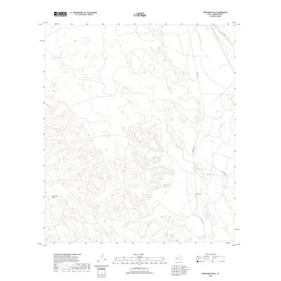
2019 Map of Frenchman Hills
USGS Topo · Published 2019About this map
Frenchman Hills and Hawk Hill dominate this arid Presidio County landscape, where deep arroyos and intermittent drainage systems define the high desert topography. This 2019 survey documents the rugged cattle country of the Big Bend region, centered on the transit corridors of Ranch Rd 169 and Casa Piedra Rd.
Find a feature on this map
10 named features on this map. Tap any name to fly to it.
Don’t see what you’re looking for? This feature index may not catch every label — zoom into the map to look around manually.
Map Details
Editions of this 2019 Frenchman Hills Map
This is the sole edition of this map. No revisions or reprints were ever made.
Other maps of this area

1895 · Marfa
USGS Topo · 1:125,000

1895 · Alpine
USGS Topo · 1:125,000

1896 · Shafter
USGS Topo · 1:125,000

1918 · Jordan Gap
USGS Topo · 1:62,500

1930 · Jordan Gap
USGS Topo · 1:62,500

1954 · Fort Stockton
USGS Topo · 1:250,000

1958 · Fort Stockton
USGS Topo · 1:250,000

1959 · Emory Peak
USGS Topo · 1:250,000

1959 · Presidio
USGS Topo · 1:250,000

1959 · Marfa
USGS Topo · 1:250,000