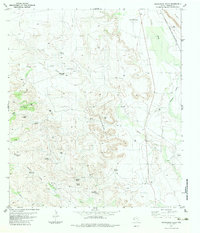
1983 Map of Frenchman Hills
USGS Topo · Published 1983About this map
Frenchman Hills dominates this high-desert landscape in Presidio County, where isolated ranching outposts and vital water sources define the human geography. The presence of the Atchison Topeka and Santa Fe railroad corridor along Alamito Creek provided a critical connection for this remote region. Land use is centered on sprawling operations like Mollard Ranch and Spur Ranch, supported by an extensive network of named water features including Whitney Windmill, Schoolhouse Windmill, and Blue Waterhole Spring. The terrain transitions from the heights of White Peak down into the drainage of Perdiz Creek, with evidence of early resource exploration found at various Oil Wells and Drill Holes. Small-scale aviation is also noted via several Landing Strips, underscoring the vast distances between these West Texas settlements.
Find a feature on this map
34 named features on this map. Tap any name to fly to it.
Don’t see what you’re looking for? This feature index may not catch every label — zoom into the map to look around manually.
Map Details
Editions of this 1983 Frenchman Hills Map
This is the sole edition of this map. No revisions or reprints were ever made.
Other maps of this area

1895 · Marfa
USGS Topo · 1:125,000

1895 · Alpine
USGS Topo · 1:125,000

1896 · Shafter
USGS Topo · 1:125,000

1918 · Jordan Gap
USGS Topo · 1:62,500

1930 · Jordan Gap
USGS Topo · 1:62,500

1954 · Fort Stockton
USGS Topo · 1:250,000

1958 · Fort Stockton
USGS Topo · 1:250,000

1959 · Emory Peak
USGS Topo · 1:250,000

1959 · Presidio
USGS Topo · 1:250,000

1959 · Marfa
USGS Topo · 1:250,000