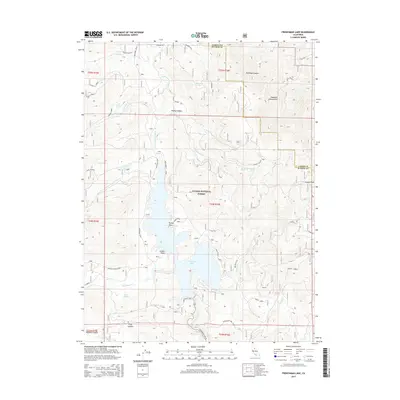
2015 Map of Frenchman Lake
USGS Topo · Published 2015About this map
Frenchman Lake dominates this high-elevation landscape within the Plumas National Forest, where the waters are held by a dam near the Frenchman Dam Vista. The lake's irregular shoreline is defined by landforms such as Turkey Point and Lunker Point, fed by the winding course of Little Last Chance Cr. To the northeast, the terrain rises sharply toward the Diamond Mountains and the prominent Crystal Peak. This 2015 survey illustrates a region largely shaped by forest management and recreation, yet it retains traces of local industry and naming at the Ramelli Rock Pit and Doyle Heights. The network of forest roads, including Frenchman Blvd and Janesville-Frenchman, provides access through steep canyons like Dooley Canyon and past numerous water sources such as Dotta Spring and Grigsby Spring.
Find a feature on this map
44 named features on this map. Tap any name to fly to it.
Don’t see what you’re looking for? This feature index may not catch every label — zoom into the map to look around manually.
Map Details
Editions of this 2015 Frenchman Lake Map
This is the sole edition of this map. No revisions or reprints were ever made.
Other maps of this area

1886 · Honey Lake
USGS Topo · 1:250,000

1890 · Sierraville
USGS Topo · 1:125,000

1891 · Honey Lake
USGS Topo · 1:250,000

1892 · Sierraville
USGS Topo · 1:125,000

1893 · Honey Lake
USGS Topo · 1:250,000

1894 · Sierraville
USGS Topo · 1:125,000

1950 · Chilcoot
USGS Topo · 1:62,500

1950 · Portola
USGS Topo · 1:62,500

1950 · Milford
USGS Topo · 1:62,500

1954 · Doyle
USGS Topo · 1:62,500