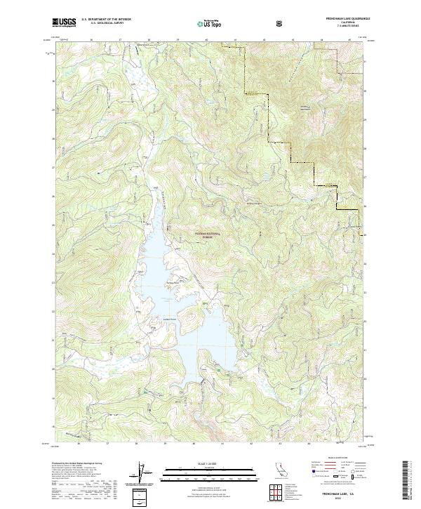
2022 Map of Frenchman Lake
USGS Topo · Published 2022About this map
Frenchman Lake and the surrounding high-altitude drainage basins of the Plumas National Forest define this terrain on the eastern edge of the Sierra Nevada. The reservoir is the central hub for local activity, featuring recreation-oriented access points like Lunker Point and Turkey Point along the western shore. The map illustrates a complex network of forest roads, including Frenchman Lake Rd and Janesville-Frenchman, which navigate the steep rises toward the Diamond Mountains. Evidence of early water rights and livestock grazing remains in the numerous named springs, such as Dotta Spring, Trosi Spring, and Griesby Spring, which feed into the Little Last Chance Cr watershed. In the northern reaches, the isolated Bodad Airport sits near the Lassen and Plumas County line, serving this remote timber and backcountry region.
Find a feature on this map
39 named features on this map. Tap any name to fly to it.
Don’t see what you’re looking for? This feature index may not catch every label — zoom into the map to look around manually.
Map Details
Editions of this 2022 Frenchman Lake Map
This is the sole edition of this map. No revisions or reprints were ever made.
Other maps of this area

1886 · Honey Lake
USGS Topo · 1:250,000

1890 · Sierraville
USGS Topo · 1:125,000

1891 · Honey Lake
USGS Topo · 1:250,000

1892 · Sierraville
USGS Topo · 1:125,000

1893 · Honey Lake
USGS Topo · 1:250,000

1894 · Sierraville
USGS Topo · 1:125,000

1950 · Chilcoot
USGS Topo · 1:62,500

1950 · Portola
USGS Topo · 1:62,500

1950 · Milford
USGS Topo · 1:62,500

1954 · Doyle
USGS Topo · 1:62,500