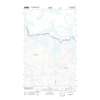
2013 Map of Friday Bay
USGS Topo · Published 2013About this map
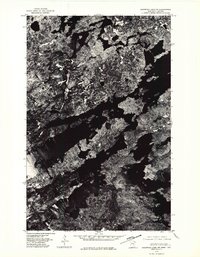
The international border between Canada and the United States winds through the waters of Crooked Lake in this northern wilderness region. Located within the Superior National Forest, the landscape is dominated by a complex network of glacial lakes and interconnecting waterways. A prominent inlet, Friday Bay, reaches southward from the main body of Crooked Lake, surrounded by a high density of smaller water bodies including Sinneeg Lake, Papoose Lake, and Bunggee Lake. This area on the boundary of St. Louis and Lake Counties remains largely undeveloped, characterized by the absence of roads and the preservation of its natural hydrology. Waterways like Bunggee Cr and Sinneeg Cr drain the high ground, while more isolated basins such as Ritual Lake and Pakwene Lake punctuate the forest interior.
Find a feature on this map
27 named features on this map. Tap any name to fly to it.
Don’t see what you’re looking for? This feature index may not catch every label — zoom into the map to look around manually.
Map Details
Editions of this 2013 Friday Bay Map
This is the sole edition of this map. No revisions or reprints were ever made.
Other maps of this area

1957 · Basswood Lake
USGS Topo · 1:62,500

1957 · Quetico
USGS Topo · 1:250,000

1963 · Fourtown Lake
USGS Topo · 1:24,000
1963 · Angleworm Lake
USGS Topo · 1:24,000
1963 · Friday Bay
USGS Topo · 1:24,000
1963 · Iron Lake
USGS Topo · 1:24,000

1968 · Quetico
USGS Topo · 1:250,000
1976 · Basswood Lake SW
USGS Topo · 1:24,000
1976 · Basswood Lake NW
USGS Topo · 1:24,000

1977 · Basswood Lake
USGS Topo · 1:100,000