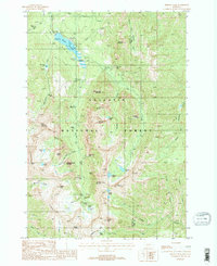
1988 Map of Fridley Peak
USGS Topo · Published 1988About this map
Hyalite Ridge and the high peaks of the Gallatin National Forest define this 1980s landscape, captured just before the turn of the millennium. The map centers on the hydrological complex of Hyalite Reservoir, where recreational infrastructure like the Hood Creek Campground and Chisholm Campground served visitors long before modern digital mapping. Moving south into the higher elevations, the terrain becomes a dense network of water features, from the dramatic drop of Silken Skein Falls and Grotto Falls to the alpine basins holding Arden Lake and Fridley Lakes. These landmarks reflect the area's transition into a managed wilderness, where the Window Rock F S Station and the History Rock Trail provided access to a geography punctuated by descriptively named summits like The Mummy, Elephant Mountain, and Sleeping Giant Mountain. This provisional survey documents the existing trails and forest service outposts that supported the region's late-20th-century expansion of outdoor recreation.
Find a feature on this map
59 named features on this map. Tap any name to fly to it.
Don’t see what you’re looking for? This feature index may not catch every label — zoom into the map to look around manually.
Map Details
Editions of this 1988 Fridley Peak Map
2 editions found
Other maps of this area

1888 · Three Forks
USGS Topo · 1:250,000

1891 · Livingston
USGS Topo · 1:250,000

1893 · Livingston
USGS Topo · 1:250,000

1894 · Three Forks
USGS Topo · 1:250,000

1895 · Three Forks
USGS Topo · 1:250,000

1947 · Bozeman
USGS Topo · 1:250,000

1948 · Bozeman
USGS Topo · 1:250,000

1951 · Bozeman Pass
USGS Topo · 1:62,500

1953 · Bozeman
USGS Topo · 1:62,500

1955 · Bozeman
USGS Topo · 1:250,000