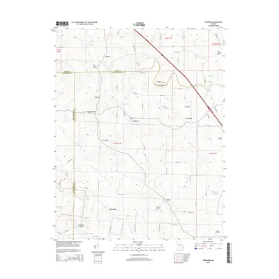
2015 Map of Friedheim
USGS Topo · Published 2015About this map
Friedheim sits at the center of this rural landscape, which spans the tri-county corner of Perry, Cape Girardeau, and Bollinger. The settlement pattern here reflects a history of small agricultural communities and family farmsteads connected by a dense web of county roads such as Co Road 411 and Co Road 516. Numerous cemeteries, including Saint Maurus Cemetery near Biehle and Saint Joseph Cemetery to the northeast, serve as vital landmarks for genealogical research. The drainage network is particularly detailed, showing the intricate paths of Apple Cr, Caney Fork, and Upper Whitewater Creek. Notable local sites like Conrads Mill and Arnsberg indicate long-standing points of habitation and industry along these waterways, while Stallings Brothers Lake provides a localized water feature in the southeastern portion of the map.
Find a feature on this map
81 named features on this map. Tap any name to fly to it.
Don’t see what you’re looking for? This feature index may not catch every label — zoom into the map to look around manually.
Map Details
Editions of this 2015 Friedheim Map
This is the sole edition of this map. No revisions or reprints were ever made.
Other maps of this area

1918 · Altenburg
USGS Topo · 1:62,500

1922 · Cape Girardeau
USGS Topo · 1:62,500

1923 · Perryville
USGS Topo · 1:62,500

1924 · Cape Girardeau
USGS Topo · 1:62,500

1924 · Perryville
USGS Topo · 1:62,500

1925 · Altenburg
USGS Topo · 1:62,500

1933 · Marble Hill
USGS Topo · 1:62,500

1937 · Marble Hill
USGS Topo · 1:62,500

1947 · Crosstown
USGS Topo · 1:24,000

1947 · Oak Ridge
USGS Topo · 1:24,000