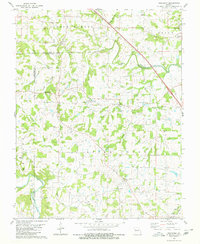
1980 Map of Friedheim
USGS Topo · Published 1980About this map
Apple Creek meanders across this landscape, defining the northern border between Perry and Cape Girardeau counties. Small farming communities such as Friedheim and Biehle serve as the primary hubs in an area characterized by numerous family and church burial grounds. Notable sites include St Maurus Cem, Dickman Cem, and Sides Cem, which reflect the localized settlement patterns of the late 20th century.
Find a feature on this map
36 named features on this map. Tap any name to fly to it.
Don’t see what you’re looking for? This feature index may not catch every label — zoom into the map to look around manually.
Map Details
Editions of this 1980 Friedheim Map
2 editions found
Other maps of this area

1918 · Altenburg
USGS Topo · 1:62,500

1922 · Cape Girardeau
USGS Topo · 1:62,500

1923 · Perryville
USGS Topo · 1:62,500

1924 · Cape Girardeau
USGS Topo · 1:62,500

1924 · Perryville
USGS Topo · 1:62,500

1925 · Altenburg
USGS Topo · 1:62,500

1933 · Marble Hill
USGS Topo · 1:62,500

1937 · Marble Hill
USGS Topo · 1:62,500

1947 · Crosstown
USGS Topo · 1:24,000

1947 · Oak Ridge
USGS Topo · 1:24,000