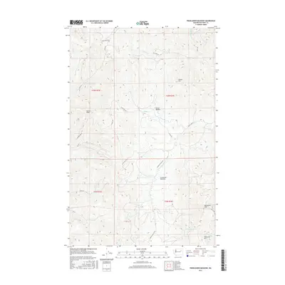
2017 Map of Friedlander Meadows
USGS Topo · Published 2017About this map
Friedlander Meadows and Sclome Meadow anchor this high-elevation interior of Ferry County, where the landscape is defined by a dense network of creek drainages and forest access routes. The map detail highlights the rugged topography of Sclome Mtn and Whitestone Mtn, which rise sharply above the intricate headwaters of the S Fork Ninemile Cr and Sclome Cr. The area is largely accessible through a system of Bureau of Indian Affairs roads, such as Bia RD 1041 and Bia RD 1042, alongside the prominent Ninemile-Hellgate Rd. These routes track the natural contours of the land, weaving between Watson Ridge and Whitestone Ridge, reflecting a long history of resource management and rural transit in this mountainous pocket of Washington.
Find a feature on this map
30 named features on this map. Tap any name to fly to it.
Don’t see what you’re looking for? This feature index may not catch every label — zoom into the map to look around manually.
Map Details
Editions of this 2017 Friedlander Meadows Map
This is the sole edition of this map. No revisions or reprints were ever made.
Other maps of this area

1948 · Wilbur
USGS Topo · 1:62,500

1948 · Wilmont Creek
USGS Topo · 1:62,500

1948 · Lincoln
USGS Topo · 1:62,500

1950 · Lincoln
USGS Topo · 1:62,500

1950 · Wilmont Creek
USGS Topo · 1:62,500

1950 · Wilbur
USGS Topo · 1:62,500

1952 · Keller
USGS Topo · 1:62,500

1953 · Ritzville
USGS Topo · 1:250,000

1954 · Okanogan
USGS Topo · 1:250,000

1956 · Wilmont Creek
USGS Topo · 1:62,500