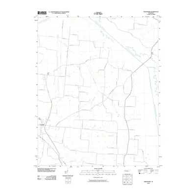
2010 Map of Friendship
USGS Topo · Published 2010About this map
The Friendship community serves as the primary hub of this Western Tennessee landscape, situated amidst a dense network of tributaries feeding into the North Fork Forked Deer River and Middle Fork Forked Deer River. The region's history is preserved in its burial grounds and postal routes, featuring the Belle Vernon Cemetery and rural service points such as the Tigrett Post Office and Eaton Post Office. The road network reflects a deeply rooted agrarian society, where family and landmark names define the geography, from Mays Cemetery Rd to the route along Providence Church Rd.
Find a feature on this map
62 named features on this map. Tap any name to fly to it.
Don’t see what you’re looking for? This feature index may not catch every label — zoom into the map to look around manually.
Map Details
Editions of this 2010 Friendship Map
This is the sole edition of this map. No revisions or reprints were ever made.
Other maps of this area

1939 · Dyersburg
USGS Topo · 1:62,500

1939 · Halls
USGS Topo · 1:62,500

1952 · Bonicord
USGS Topo · 1:24,000

1952 · Newbern
USGS Topo · 1:24,000

1952 · Chestnut Bluff
USGS Topo · 1:24,000

1956 · Dyersburg
USGS Topo · 1:250,000

1956 · Blytheville
USGS Topo · 1:250,000

1959 · Blytheville
USGS Topo · 1:250,000

1961 · Halls
USGS Topo · 1:62,500
1961 · Dyersburg
USGS Topo · 1:62,500