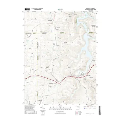
2014 Map of Friendsville
USGS Topo · Published 2014About this map
Friendsville serves as the focal point for this survey of the northern Appalachian highlands, where the Youghiogheny River carves through a landscape of ridges and hollows at the intersection of Maryland, Pennsylvania, and West Virginia. The historical National Pike traverses the northern edge near Markleysburg, tracing a route that has defined regional commerce for generations. The terrain is marked by numerous family-named landmarks and small settlements like Asher Glade and Blooming Rose, suggesting a legacy of close-knit mountain communities.
Find a feature on this map
121 named features on this map. Tap any name to fly to it.
Don’t see what you’re looking for? This feature index may not catch every label — zoom into the map to look around manually.
Map Details
Editions of this 2014 Friendsville Map
This is the sole edition of this map. No revisions or reprints were ever made.
Other maps of this area

1900 · Accident
USGS Topo · 1:62,500

1900 · Uniontown
USGS Topo · 1:62,500

1904 · Bruceton
USGS Topo · 1:62,500

1922 · Confluence
USGS Topo · 1:62,500

1926 · Bruceton
USGS Topo · 1:62,500

1931 · Uniontown
USGS Topo · 1:62,500

1931 · Confluence
USGS Topo · 1:62,500

1931 · Bruceton Mills
USGS Topo · 1:62,500

1933 · Confluence
USGS Topo · 1:62,500

1933 · Bruceton
USGS Topo · 1:62,500