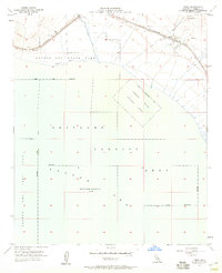
1956 Map of Frink
USGS Topo · Published 1959About this map
Salton Sea waters dominate this mid-century landscape, recorded here at an elevation 235 feet below sea level. Along the northeastern shore, the Southern Pacific railroad corridor links the small settlements of Frink and Pope. This desert shoreline represents a complex overlap of recreation and military utility, where the leisure of the Salton Sea State Park and Bombay Beach sits adjacent to restricted zones. Vast portions of the water are designated for tactical use, including a Seaplane Landing Area and a Naval Aerial Laying Mine Area. On land, the arid terrain near Frink Spring is marked by several gravel pits and a remote Landing Strip, reflecting the infrastructure required to maintain this isolated stretch of the Imperial Valley.
Find a feature on this map
20 named features on this map. Tap any name to fly to it.
Don’t see what you’re looking for? This feature index may not catch every label — zoom into the map to look around manually.
Map Details
Editions of this 1956 Frink Map
3 editions found
Other maps of this area

1940 · Kane Spring
USGS Topo · 1:62,500

1940 · Frink
USGS Topo · 1:62,500

1940 · Durmid
USGS Topo · 1:62,500

1944 · Durmid
USGS Topo · 1:62,500

1944 · Kane Spring
USGS Topo · 1:62,500

1944 · Calipatria
USGS Topo · 1:62,500

1944 · Frink
USGS Topo · 1:62,500

1954 · Salton Sea
USGS Topo · 1:250,000

1955 · Salton Sea
USGS Topo · 1:250,000

1956 · Frink NW
USGS Topo · 1:24,000