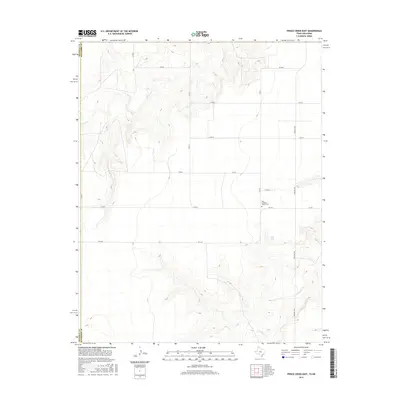
2016 Map of Frisco Creek East
USGS Topo · Published 2016About this map
Oslo Lutheran Church and its accompanying Cem stand as a central landmark in this portion of the High Plains near the Oklahoma-Texas border. This 2016 survey illustrates the structured agricultural grid of the Panhandle, where long, straight routes like Farm Rd 1262 and FM 2349 intersect with numerous numbered county roads. The landscape is defined by the winding drainages of Frisco Cr in the northwest and Coldwater Cr in the southeast, providing a sharp topographic contrast to the surrounding flat farmland. These seasonal waterways and small catchments, such as Steji Lake, remain critical features for local land management and cattle ranching in an area where the state line between Sherman Co and Hansford Co meets the Oklahoma boundary.
Find a feature on this map
18 named features on this map. Tap any name to fly to it.
Don’t see what you’re looking for? This feature index may not catch every label — zoom into the map to look around manually.
Map Details
Editions of this 2016 Frisco Creek East Map
This is the sole edition of this map. No revisions or reprints were ever made.
Other maps of this area

1954 · Perryton
USGS Topo · 1:250,000

1958 · Perryton
USGS Topo · 1:250,000

1968 · Guymon SW
USGS Topo · 1:24,000

1973 · Goodwell SE
USGS Topo · 1:24,000

1973 · Goodwell
USGS Topo · 1:24,000

1973 · Gruver
USGS Topo · 1:24,000

1974 · Sunray 1 NW
USGS Topo · 1:24,000

1974 · Sunray 1 SW
USGS Topo · 1:24,000

1974 · Sunray 1 SE
USGS Topo · 1:24,000

1974 · Sunray 1 NE
USGS Topo · 1:24,000