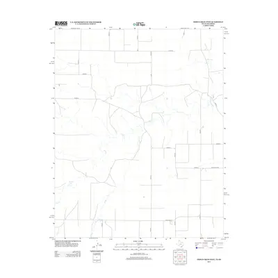
2012 Map of Frisco Creek West
USGS Topo · Published 2012About this map
Frisco Cr meanders across this high plains landscape in the Oklahoma Panhandle, carving a winding path through the rectangular grid of rural roads that defines Texas County. The hydrology of the region is further marked by Runyan Lake, a distinct water feature in an area dominated by agricultural sections and long, straight thoroughfares. Surveyed in 2012 by the U.S. Geological Survey, this map reflects the modern layout of rural infrastructure, where county roads like Co Road C and Ranch Road 2349 intersect the natural drainage patterns of the Frisco Creek watershed. The spatial organization of the land remains deeply tied to the township and range system, providing a clear view of how water resources and road networks interact in this part of Oklahoma.
Find a feature on this map
2 named features on this map. Tap any name to fly to it.
Don’t see what you’re looking for? This feature index may not catch every label — zoom into the map to look around manually.
Map Details
Editions of this 2012 Frisco Creek West Map
This is the sole edition of this map. No revisions or reprints were ever made.
Other maps of this area

1954 · Perryton
USGS Topo · 1:250,000

1958 · Perryton
USGS Topo · 1:250,000

1973 · Goodwell SE
USGS Topo · 1:24,000

1973 · Texhoma North
USGS Topo · 1:24,000

1973 · Goodwell
USGS Topo · 1:24,000

1974 · Sunray 1 NW
USGS Topo · 1:24,000

1974 · Texhoma South
USGS Topo · 1:24,000

1974 · Stevens SE
USGS Topo · 1:24,000

1974 · Sunray 1 SW
USGS Topo · 1:24,000

1974 · Sunray 1 SE
USGS Topo · 1:24,000