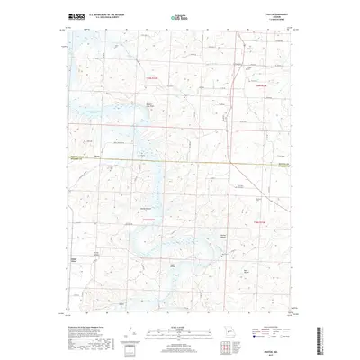
2017 Map of Fristoe
USGS Topo · Published 2017About this map
The Harry S Truman Reservoir dominates the western half of this landscape, its fingers reaching into deep ravines and hollows along the Benton Co Hickory Co line. Near the northern edge, the settlement of Fristoe serves as a local hub, surrounded by family burial grounds like the Fristoe Cem and Joplin Cem. The terrain is defined by a dense network of hollows, such as Mining Hollow and Sugarcamp Hollow, that drain toward the Pomme de Terre River and its various tributaries. To the south, the village of Avery and the community of White Cloud sit on higher ground away from the reservoir's flood pool. Genealogists will find a high concentration of rural cemeteries, including South New Home Cem and Pippens Cem, which mark the historical footprint of these Ozark communities before and after the creation of the reservoir.
Find a feature on this map
73 named features on this map. Tap any name to fly to it.
Don’t see what you’re looking for? This feature index may not catch every label — zoom into the map to look around manually.
Map Details
Editions of this 2017 Fristoe Map
This is the sole edition of this map. No revisions or reprints were ever made.
Other maps of this area

1884 · Bolivar
USGS Topo · 1:125,000

1887 · Warsaw
USGS Topo · 1:125,000

1892 · Bolivar
USGS Topo · 1:125,000

1894 · Warsaw
USGS Topo · 1:125,000

1935 · Edwards
USGS Topo · 1:24,000

1935 · Dell
USGS Topo · 1:24,000

1945 · Fristoe
USGS Topo · 1:62,500

1947 · Jefferson City
USGS Topo · 1:250,000
1951 · Hermitage
USGS Topo · 1:62,500

1954 · Jefferson City
USGS Topo · 1:250,000