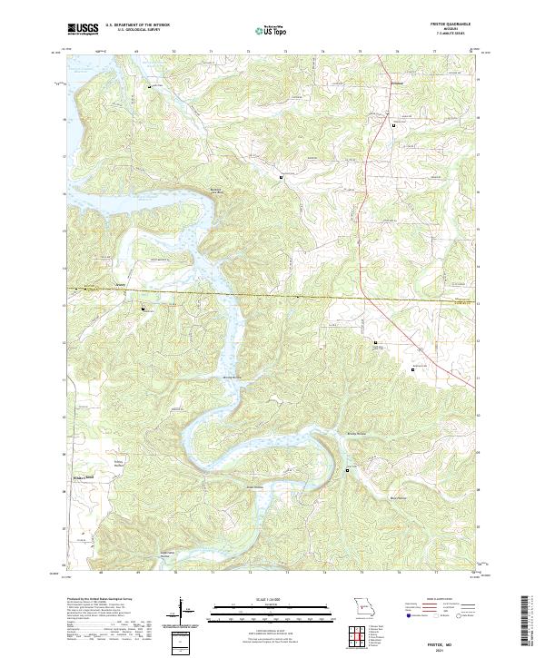
2021 Map of Fristoe
USGS Topo · Published 2021About this map
Harry S Truman Reservoir dominates the northern reaches of this Missouri landscape, where its waters meet the rugged drainages of the Pomme de Terre River. The settlement of Fristoe serves as a local hub near the Benton and Hickory county line, surrounded by several smaller communities like Avery and White Cloud. The terrain is defined by a dense network of hollows, including the intriguing Mining Hollow and Buzzard Cave Bluff, which reflect the area's deep-rooted physical geography.
Find a feature on this map
70 named features on this map. Tap any name to fly to it.
Don’t see what you’re looking for? This feature index may not catch every label — zoom into the map to look around manually.
Map Details
Editions of this 2021 Fristoe Map
This is the sole edition of this map. No revisions or reprints were ever made.
Other maps of this area

1884 · Bolivar
USGS Topo · 1:125,000

1887 · Warsaw
USGS Topo · 1:125,000

1892 · Bolivar
USGS Topo · 1:125,000

1894 · Warsaw
USGS Topo · 1:125,000

1935 · Edwards
USGS Topo · 1:24,000

1935 · Dell
USGS Topo · 1:24,000

1945 · Fristoe
USGS Topo · 1:62,500

1947 · Jefferson City
USGS Topo · 1:250,000
1951 · Hermitage
USGS Topo · 1:62,500

1954 · Jefferson City
USGS Topo · 1:250,000