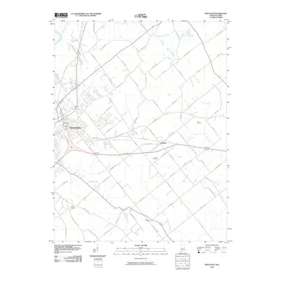
2010 Map of Fritchton
USGS Topo · Published 2010About this map
Vincennes and its eastern agricultural surroundings are meticulously documented in this 2010 survey, showcasing the transition from the city's edge into the rural Knox County countryside. The landscape is defined by the drainage patterns of the Wabash River and its various tributaries, including Smalls Creek and Upper River Deshee. The map reveals a dense network of local roads that link the primary hub of Vincennes to smaller communities such as Fritchton and Verne. Genealogists and local historians will find significant value in the clear identification of several burial grounds, such as Root Cemetery, Fritchton Cemetery, and Highland Cemetery, which are scattered throughout the township. The mix of historical highway alignments like E Old Hwy 50 and modern infrastructure provides a detailed view of how transportation and settlement have evolved along these traditional Indiana routes.
Find a feature on this map
80 named features on this map. Tap any name to fly to it.
Don’t see what you’re looking for? This feature index may not catch every label — zoom into the map to look around manually.
Map Details
Editions of this 2010 Fritchton Map
This is the sole edition of this map. No revisions or reprints were ever made.
Other maps of this area

1915 · Vincennes
USGS Topo · 1:62,500

1917 · Birds
USGS Topo · 1:62,500

1942 · Fritchton
USGS Topo · 1:24,000

1942 · Birds
USGS Topo · 1:62,500

1943 · Oaktown
USGS Topo · 1:24,000

1943 · Bicknell
USGS Topo · 1:24,000

1944 · Fritchton
USGS Topo · 1:24,000

1944 · Monroe City
USGS Topo · 1:24,000

1944 · Wheatland
USGS Topo · 1:24,000

1944 · Iona
USGS Topo · 1:24,000