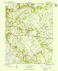
1942 Map of Fritchton
USGS Topo · Published 1942About this map
Fritchton sits at the heart of this landscape, serving as a central hub for the Palmyra and Washington townships during the early 1940s. The area is defined by a dense network of country churches and rural institutions, including Upper Indiana Ch, Lower Indiana Ch, and the St Vincent Orphanage near Vincennes. The presence of the Hillcrest Hospital and the nearby County Farm indicates a well-established social infrastructure for the era.
Find a feature on this map
33 named features on this map. Tap any name to fly to it.
Don’t see what you’re looking for? This feature index may not catch every label — zoom into the map to look around manually.
Map Details
Editions of this 1942 Fritchton Map
2 editions found
Other maps of this area

1915 · Vincennes
USGS Topo · 1:62,500

1917 · Birds
USGS Topo · 1:62,500

1942 · Fritchton
USGS Topo · 1:24,000

1942 · Birds
USGS Topo · 1:62,500

1943 · Oaktown
USGS Topo · 1:24,000

1943 · Bicknell
USGS Topo · 1:24,000

1944 · Fritchton
USGS Topo · 1:24,000

1944 · Monroe City
USGS Topo · 1:24,000

1944 · Wheatland
USGS Topo · 1:24,000

1944 · Iona
USGS Topo · 1:24,000