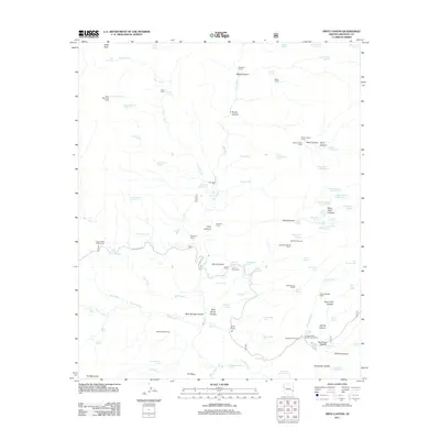
2011 Map of Fritz Canyon
USGS Topo · Published 2011About this map
Blue River flows through the center of this 2011 survey, a region characterized by a high concentration of working cattle infrastructure and unique water sources in Greenlee County. The map documents the localized names of high-desert springs and tanks, including the curiously named Tea Bag Springs Number One, Black Coffee Spring, and Lemonade Spring. Settlement history is visible through several family-named landmarks like Fritz Ranch and Stacy Ranch, alongside high-elevation outposts such as Horse Canyon Cabin and Cienega Corral Cabin. The area's ranching heritage is further detailed by an extensive network of corrals, from the Joe Fritz Corral to the Roan Cow Corral. Land features like Alder Peak and Pat Mesa define the topographic relief, while Juan Miller Rd provides the primary vehicular access through this corner of Arizona.
Find a feature on this map
106 named features on this map. Tap any name to fly to it.
Don’t see what you’re looking for? This feature index may not catch every label — zoom into the map to look around manually.
Map Details
Editions of this 2011 Fritz Canyon Map
This is the sole edition of this map. No revisions or reprints were ever made.
Other maps of this area

1902 · Clifton
USGS Topo · 1:62,500

1913 · Morenci
USGS Topo · 1:125,000

1915 · Morenci
USGS Topo · 1:125,000

1954 · Clifton
USGS Topo · 1:250,000

1957 · Clifton
USGS Topo · 1:250,000

1958 · Clifton
USGS Topo · 1:250,000

1962 · Clifton
USGS Topo · 1:250,000

1962 · Clifton
USGS Topo · 1:62,500

1962 · Big Lue Mts
USGS Topo · 1:62,500
1967 · Alma Mesa
USGS Topo · 1:24,000