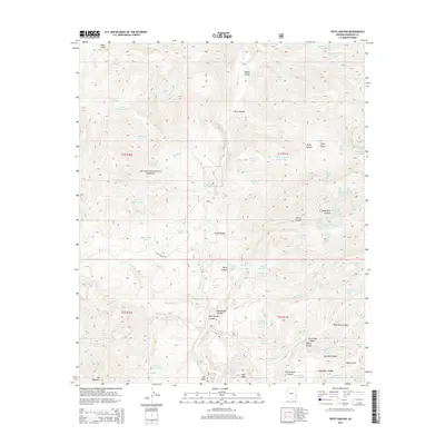
2014 Map of Fritz Canyon
USGS Topo · Published 2014About this map
Apache National Forest lands dominate this 2014 terrain study, centered on the confluence of the Blue River and Fritz Canyon. The landscape is a complex network of high mesas and deep drainages, including Maple Canyon, Horse Canyon, and the curiously named Suicide Canyon to the southeast. Water sources are critical identifiers in this environment, with numerous tanks and springs distributed throughout the range, such as Winter Camp Tank, Hobo Spring, and the series of Tea Bag Springs.
Find a feature on this map
93 named features on this map. Tap any name to fly to it.
Don’t see what you’re looking for? This feature index may not catch every label — zoom into the map to look around manually.
Map Details
Editions of this 2014 Fritz Canyon Map
This is the sole edition of this map. No revisions or reprints were ever made.
Other maps of this area

1902 · Clifton
USGS Topo · 1:62,500

1913 · Morenci
USGS Topo · 1:125,000

1915 · Morenci
USGS Topo · 1:125,000

1954 · Clifton
USGS Topo · 1:250,000

1957 · Clifton
USGS Topo · 1:250,000

1958 · Clifton
USGS Topo · 1:250,000

1962 · Clifton
USGS Topo · 1:250,000

1962 · Clifton
USGS Topo · 1:62,500

1962 · Big Lue Mts
USGS Topo · 1:62,500
1967 · Alma Mesa
USGS Topo · 1:24,000