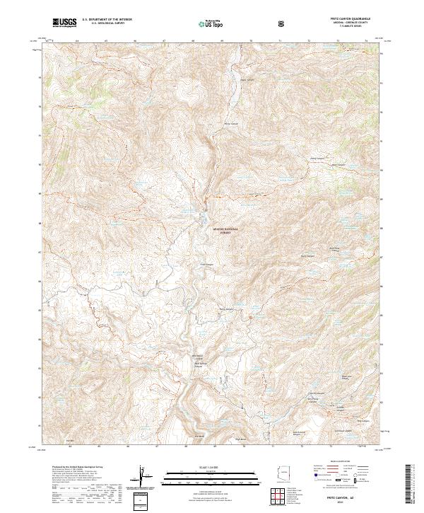
2021 Map of Fritz Canyon
USGS Topo · Published 2021About this map
Apache National Forest lands dominate this corner of Greenlee County, where the Blue River carves through a landscape defined by sharp canyons and high, isolated mesas. In the northern reaches, Maple Canyon and Horse Canyon descend toward the river valley, while to the south, prominent landmarks like Pat Mesa and High Mesa rise above the confluence of Fritz Canyon and the Blue River.
Find a feature on this map
111 named features on this map. Tap any name to fly to it.
Don’t see what you’re looking for? This feature index may not catch every label — zoom into the map to look around manually.
Map Details
Editions of this 2021 Fritz Canyon Map
This is the sole edition of this map. No revisions or reprints were ever made.
Other maps of this area

1902 · Clifton
USGS Topo · 1:62,500

1913 · Morenci
USGS Topo · 1:125,000

1915 · Morenci
USGS Topo · 1:125,000

1954 · Clifton
USGS Topo · 1:250,000

1957 · Clifton
USGS Topo · 1:250,000

1958 · Clifton
USGS Topo · 1:250,000

1962 · Clifton
USGS Topo · 1:250,000

1962 · Clifton
USGS Topo · 1:62,500

1962 · Big Lue Mts
USGS Topo · 1:62,500
1967 · Alma Mesa
USGS Topo · 1:24,000