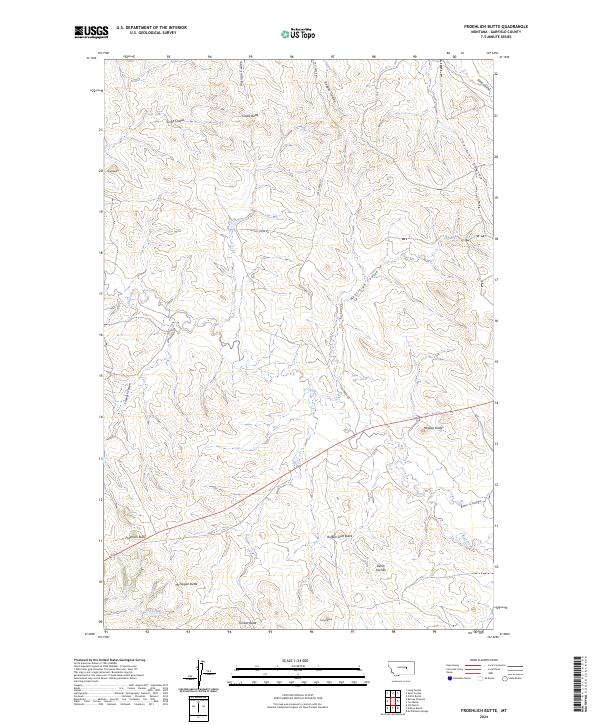
2024 Map of Froehlich Butte
USGS Topo · Published 2024About this map
Hill Ranch and Dutton Ranch occupy the high-plains landscape of Garfield County, where a complex network of ephemeral drainages carves through the Missouri River breaks region. This contemporary survey documents a terrain defined by steep-sided buttes and winding coulees, including the prominent Froehlich Butte and the curiously named Devils Kitchen. The mapping reflects a sparse, ranching-oriented settlement pattern where water sources like McWilliams Springs are critical landmarks. Human activity is largely concentrated along unpaved routes such as Calf Creek Rd and Lo Ln, which navigate the elevation changes between Castle Butte and McTwigan Butte. The presence of several distinct coulees, including Morrison Coulee and Hensleigh Coulee, illustrates the intense erosional history of this semi-arid rangeland.
Find a feature on this map
36 named features on this map. Tap any name to fly to it.
Don’t see what you’re looking for? This feature index may not catch every label — zoom into the map to look around manually.
Map Details
Editions of this 2024 Froehlich Butte Map
This is the sole edition of this map. No revisions or reprints were ever made.
Other maps of this area

1954 · Jordan
USGS Topo · 1:250,000

1954 · Forsyth
USGS Topo · 1:250,000

1956 · Jordan
USGS Topo · 1:250,000

1957 · Forsyth
USGS Topo · 1:250,000

1958 · Jordan
USGS Topo · 1:250,000

1958 · Forsyth
USGS Topo · 1:250,000
1963 · Hill Ranch
USGS Topo · 1:24,000

1963 · Mc Williams Springs
USGS Topo · 1:24,000
1963 · Dutton Ranch
USGS Topo · 1:24,000

1964 · Jordan
USGS Topo · 1:250,000