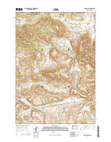
2014 Map of Frog Hollow
USGS Topo · Published 2014About this map
Caleb Cem and the former logging site at Spoos Mill sit along the winding corridor of the Ochoco Hwy in this part of Wheeler County. The landscape is defined by its drainages and high meadows, where water is managed through a series of small impoundments such as Fopiano Reservoir, Collins Reservoir, and Fort Creek Reservoir. Named terrain features like Juniper Butte and the grassy expanse of Bearway Meadow indicate a long history of ranching and timber activity in the region.
Find a feature on this map
34 named features on this map. Tap any name to fly to it.
Don’t see what you’re looking for? This feature index may not catch every label — zoom into the map to look around manually.
Map Details
Editions of this 2014 Frog Hollow Map
This is the sole edition of this map. No revisions or reprints were ever made.
Other maps of this area

1926 · Mitchell
USGS Topo · 1:125,000

1932 · Dayville
USGS Topo · 1:125,000

1936 · Dayville
USGS Topo · 1:125,000

1953 · Richmond
USGS Topo · 1:62,500

1955 · Bend
USGS Topo · 1:250,000

1955 · Canyon City
USGS Topo · 1:250,000

1957 · Bend
USGS Topo · 1:250,000

1958 · Bend
USGS Topo · 1:250,000

1959 · Canyon City
USGS Topo · 1:250,000

1966 · Peterson Point
USGS Topo · 1:24,000