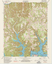
1978 Map of Frogue
USGS Topo · Published 1988About this map
The Cumberland River curves through the northwestern corner of this landscape, just before the terrain descends into the complex, branching fingers of Dale Hollow Lake. This 1978 revision captures a transition in the local economy and land use, where dozens of scattered Oil Wells dot the ridges above the water, particularly around Modoc and Kettle. The map reveals a deeply entrenched rural network defined by family and community landmarks like New Sulphur Ch, Spears Chapel, and Grace Cem.
Find a feature on this map
56 named features on this map. Tap any name to fly to it.
Don’t see what you’re looking for? This feature index may not catch every label — zoom into the map to look around manually.
Map Details
Editions of this 1978 Frogue Map
2 editions found
Other maps of this area

1924 · Lillydale
USGS Topo · 1:62,500

1926 · Lillydale
USGS Topo · 1:62,500

1929 · Lillydale
USGS Topo · 1:62,500

1929 · Byrdstown
USGS Topo · 1:62,500

1953 · Waterview
USGS Topo · 1:24,000

1953 · Burkesville
USGS Topo · 1:24,000

1953 · Wolf Creek Dam
USGS Topo · 1:24,000

1954 · Frogue
USGS Topo · 1:24,000

1954 · Blacks Ferry
USGS Topo · 1:24,000

1954 · Albany
USGS Topo · 1:24,000