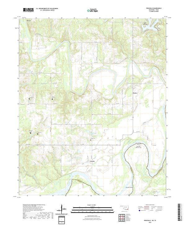
2022 Map of Frogville
USGS Topo · Published 2022About this map
Frogville and the winding southern border of Oklahoma define this landscape where the Kiamichi River meets the Red River. The geography is shaped by the river's shifting path, most notably at the Everidge Lake Cut-off, which sits just across the state line from Texas. This corner of Choctaw County preserves a significant genealogical record through numerous small burial sites, including Frogville Cem, Missionary Cem, and Oakes Cem, many of which are tucked away near Spring Hill Rd. To the north, the settlement of Fort Towson stands near the confluence of Gates Cr and Cedar Creek, serving as a historic anchor for the region. The map captures a rural network of section roads like E 2140 Rd and E 2090 Rd that navigate the low-lying basins and reservoirs such as Frogville Cr Site 2 Reservoir.
Find a feature on this map
45 named features on this map. Tap any name to fly to it.
Don’t see what you’re looking for? This feature index may not catch every label — zoom into the map to look around manually.
Map Details
Editions of this 2022 Frogville Map
This is the sole edition of this map. No revisions or reprints were ever made.
Other maps of this area

1901 · Alikchi
USGS Topo · 1:125,000

1950 · Mcalester
USGS Topo · 1:250,000

1951 · Slate Shoals
USGS Topo · 1:24,000

1951 · Frogville
USGS Topo · 1:24,000

1951 · Shoals
USGS Topo · 1:24,000

1951 · Kiomatia
USGS Topo · 1:24,000

1951 · Woodland
USGS Topo · 1:24,000

1951 · Manchester
USGS Topo · 1:24,000

1953 · Texarkana
USGS Topo · 1:250,000

1956 · Texarkana
USGS Topo · 1:250,000