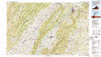
1986 Map of Front Royal
USGS Topo · Published 1989About this map
Massanutten Mountain divides the landscape into distinct parallel valleys in this mid-1980s look at the northern Shenandoah region. The Shenandoah River meanders dramatically through the Page Valley, while the North Fork Shenandoah River anchors the settlement corridor to the west. In Front Royal, the presence of the Randolph-Macon Academy and the Shenandoah College and Conservatory of Music marks the town as a regional educational hub at the northern entrance to Shenandoah National Park.
Find a feature on this map
213 named features on this map. Tap any name to fly to it.
Don’t see what you’re looking for? This feature index may not catch every label — zoom into the map to look around manually.
Map Details
Editions of this 1986 Front Royal Map
3 editions found
Other maps of this area

1884 · Harpers Ferry
USGS Topo · 1:125,000

1887 · Spottsylvania
USGS Topo · 1:125,000

1891 · Harpers Ferry
USGS Topo · 1:125,000

1891 · Romney
USGS Topo · 1:125,000

1892 · Spottsylvania
USGS Topo · 1:125,000

1892 · Franklin
USGS Topo · 1:125,000

1892 · Woodstock
USGS Topo · 1:125,000

1892 · Gordonsville
USGS Topo · 1:125,000

1892 · Harrisonburg
USGS Topo · 1:125,000

1893 · Luray
USGS Topo · 1:125,000