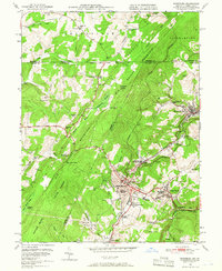
1949 Map of Frostburg
USGS Topo · Published 1966About this map
Frostburg and its surrounding coal-mining communities stand at the heart of this post-war survey, documenting the industrial landscape of the late 1940s. The map captures the dense network of the Western Maryland and Cumberland And Pennsylvania railroads, which facilitated the movement of coal from local operations like Eckhart Mines and Borden Shaft. Significant institutions such as Frostburg State Teachers College and Allegany High Sch anchor the town, while smaller settlements like Zihlman, Grahamtown, and Midlothian reflect the region's historic residential patterns.
Find a feature on this map
70 named features on this map. Tap any name to fly to it.
Don’t see what you’re looking for? This feature index may not catch every label — zoom into the map to look around manually.
Map Details
Editions of this 1949 Frostburg Map
3 editions found
Other maps of this area

1898 · Frostburg
USGS Topo · 1:62,500

1899 · Grantsville
USGS Topo · 1:62,500

1901 · Frostburg
USGS Topo · 1:62,500

1904 · Grantsville
USGS Topo · 1:62,500

1908 · Frostburg
USGS Topo · 1:62,500

1921 · Meyersdale
USGS Topo · 1:62,500

1923 · Berlin
USGS Topo · 1:48,000

1929 · Berlin
USGS Topo · 1:62,500

1939 · Meyersdale
USGS Topo · 1:62,500

1944 · Berlin
USGS Topo · 1:62,500