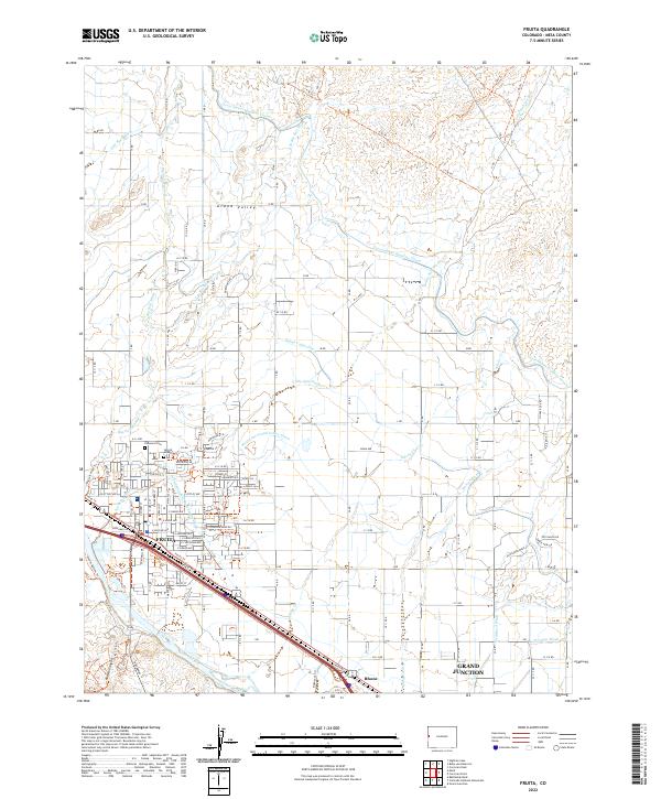
2022 Map of Fruita
USGS Topo · Published 2022About this map
Fruita and the surrounding Grand Valley are defined by a complex irrigation network essential to this semi-arid region. The Government Highline Canal and the Main Line Grand Valley Canal arc across the landscape, drawing from the Colorado River to support agricultural development north of the river's bend. This modern survey illustrates the proximity of Grand Junction to the east and the natural barriers of Red Rocks and Kodels Canyon to the southwest. Local history is anchored at Elmwood Cem and Sacred Heart Cem, while various washes such as Big Salt Wash and Hunter Wash cut through the valley floor. The map highlights the transition from the structured street grid of Fruita, with roads like E Aspen Ave and W Ottley Ave, to the more expansive rural tracts and canyons beyond.
Find a feature on this map
57 named features on this map. Tap any name to fly to it.
Don’t see what you’re looking for? This feature index may not catch every label — zoom into the map to look around manually.
Map Details
Editions of this 2022 Fruita Map
This is the sole edition of this map. No revisions or reprints were ever made.
Other maps of this area

1934 · Colorado National Monument
USGS Topo · 1:24,000

1956 · Grand Junction
USGS Topo · 1:250,000

1959 · Grand Junction
USGS Topo · 1:250,000

1960 · Grand Junction
USGS Topo · 1:250,000

1962 · Grand Junction
USGS Topo · 1:250,000

1962 · Fruita
USGS Topo · 1:24,000

1962 · Mack
USGS Topo · 1:24,000

1962 · Colorado National Monument
USGS Topo · 1:24,000
1962 · Battleship Rock
USGS Topo · 1:24,000

1962 · Grand Junction
USGS Topo · 1:24,000