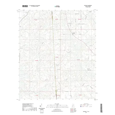
2020 Map of Fruitdale
USGS Topo · Published 2020About this map
The Escatawpa River defines the eastern landscape of this Washington County borderland, where Alabama meets Mississippi. Modern roads like Fruitdale Ave and Co Rd 1 connect the established settlements of Fruitdale and Escatawpa. The area is notably dense with family and community burial grounds, providing a significant resource for genealogical research. These include Macedonia Cem, Grimes Cem, Fruitdale Cem, and Epworth Cem, most situated along ridges between the numerous creek drainages such as Griffin Cr and Turkey Cr. The township and range lines of the Public Land Survey System divide the terrain into a regular grid, overlaying a landscape carved by Brannon Cr and Byrd Cr. This 2020 data captures the area’s contemporary rural structure, from the residential clusters along Central Ave to the forested reaches of Red Oak Ridge.
Find a feature on this map
54 named features on this map. Tap any name to fly to it.
Don’t see what you’re looking for? This feature index may not catch every label — zoom into the map to look around manually.
Map Details
Editions of this 2020 Fruitdale Map
This is the sole edition of this map. No revisions or reprints were ever made.
Other maps of this area

1942 · Deer Park
USGS Topo · 1:62,500

1943 · Deer Park
USGS Topo · 1:62,500

1953 · Hattiesburg
USGS Topo · 1:250,000

1958 · Hattiesburg
USGS Topo · 1:250,000

1964 · Knobtown
USGS Topo · 1:24,000

1964 · Clark
USGS Topo · 1:24,000

1972 · Leakesville
USGS Topo · 1:24,000

1974 · Fruitdale
USGS Topo · 1:24,000

1974 · Chatom
USGS Topo · 1:24,000

1974 · State Line
USGS Topo · 1:24,000