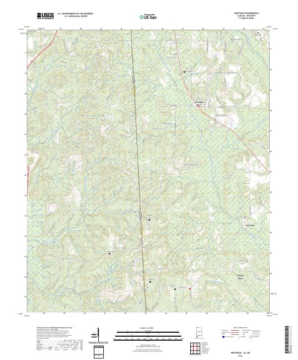
2024 Map of Fruitdale
USGS Topo · Published 2024About this map
The Alabama and Mississippi border defines the western edge of this 2024 survey, where the Piney Woods landscape transitions into the drainage basins of the Escatawpa River. The settlement of Fruitdale serves as a local hub, connected to outlying rural communities like Vinegar Bend and Escatawpa by a network of local routes including Fruitdale Ave and Co Rd 1. This modern topographic study reveals a deeply rooted rural geography, evidenced by the numerous family and community burial grounds such as Williams Cem, Macedonia Cem, and Grimes Cem that dot the wooded terrain.
Find a feature on this map
57 named features on this map. Tap any name to fly to it.
Don’t see what you’re looking for? This feature index may not catch every label — zoom into the map to look around manually.
Map Details
Editions of this 2024 Fruitdale Map
This is the sole edition of this map. No revisions or reprints were ever made.
Other maps of this area

1942 · Deer Park
USGS Topo · 1:62,500

1943 · Deer Park
USGS Topo · 1:62,500

1953 · Hattiesburg
USGS Topo · 1:250,000

1958 · Hattiesburg
USGS Topo · 1:250,000

1964 · Knobtown
USGS Topo · 1:24,000

1964 · Clark
USGS Topo · 1:24,000

1972 · Leakesville
USGS Topo · 1:24,000

1974 · Fruitdale
USGS Topo · 1:24,000

1974 · Chatom
USGS Topo · 1:24,000

1974 · State Line
USGS Topo · 1:24,000