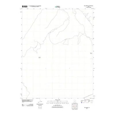
2011 Map of Fry Spring
USGS Topo · Published 2011About this map
Radium King Rd snakes across this high desert landscape of San Juan County, Utah, providing access to a remote canyon network during the early 21st century. The terrain is defined by dramatic geological formations, including the prominent Tables of the Sun in the east and the deep incision of Bullseye Canyon further west. In an arid region where water is a vital resource for both local wildlife and travelers, Fry Spring serves as a critical point of interest. The presence of Red Canyon Rd in the southwestern corner highlights the sparse but essential transportation network that links these isolated natural landmarks. This survey by the U.S. Geological Survey documents a landscape where traditional place names reflect both the physical geography and the historical mining interests of the American West.
Find a feature on this map
5 named features on this map. Tap any name to fly to it.
Don’t see what you’re looking for? This feature index may not catch every label — zoom into the map to look around manually.
Map Details
Editions of this 2011 Fry Spring Map
This is the sole edition of this map. No revisions or reprints were ever made.
Other maps of this area

1886 · Henry Mountains
USGS Topo · 1:250,000

1892 · Henry Mountains
USGS Topo · 1:250,000

1952 · Mancos Mesa
USGS Topo · 1:62,500

1952 · Natural Bridges
USGS Topo · 1:62,500

1954 · White Canyon 3 SE
USGS Topo · 1:24,000

1954 · White Canyon 4 NE
USGS Topo · 1:24,000

1954 · White Canyon 4 SE
USGS Topo · 1:24,000

1954 · White Canyon 3 NE
USGS Topo · 1:24,000

1954 · White Canyon 4 SW
USGS Topo · 1:24,000
1954 · White Canyon 4 NW
USGS Topo · 1:24,000