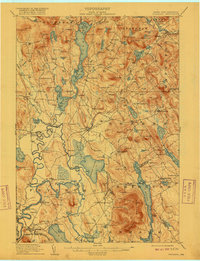
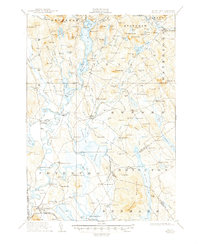
1911 Map of Fryeburg
USGS Topo · Published 1916About this map
Kezar Lake and the winding Saco River dominate this landscape, illustrating the intricate relationship between the water storage systems and local topography in western Maine. The map reveals a dense network of early 20th-century rural infrastructure, including numerous educational sites like the Menotomy School and Seavey School. Prominent landmarks such as Jockey Cap and the Battle Monument near Lovewell Pond indicate deep-seated local historical significance, while the presence of the Fairgrounds in Fryeburg points to its role as a regional hub for community gathering and agriculture.
Find a feature on this map
149 named features on this map. Tap any name to fly to it.
Don’t see what you’re looking for? This feature index may not catch every label — zoom into the map to look around manually.
Map Details
Editions of this 1911 Fryeburg Map
6 editions found
Other maps of this area

1893 · Gorham
USGS Topo · 1:62,500

1894 · North Conway
USGS Topo · 1:62,500

1896 · Norway
USGS Topo · 1:62,500

1896 · Sebago
USGS Topo · 1:62,500

1896 · North Conway
USGS Topo · 1:62,500

1896 · Gorham
USGS Topo · 1:62,500

1909 · Fryeburg
USGS Topo · 1:62,500

1910 · Kezar Falls
USGS Topo · 1:48,000

1911 · Fryeburg
USGS Topo · 1:62,500

1911 · Kezar Falls
USGS Topo · 1:62,500