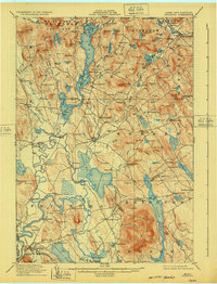
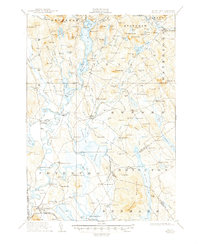
1911 Map of Fryeburg
USGS Topo · Published 1932About this map
Kezar Lake and its intricate bays dominate the center of this Maine landscape, reflecting a time when the region's economy relied heavily on its waterways and emerging timber interests. The intricate path of the Saco River winds through the southern lowlands, passing Swans Falls and the historic Battle Monument near Lovewell Pond. This area, managed in part as the White Mountain National Forest, showcases a transition from rugged upland terrain like Adams Mtn to the settled agricultural and milling pockets of Slab City and Lynchville.
Find a feature on this map
152 named features on this map. Tap any name to fly to it.
Don’t see what you’re looking for? This feature index may not catch every label — zoom into the map to look around manually.
Map Details
Editions of this 1911 Fryeburg Map
6 editions found
Other maps of this area

1893 · Gorham
USGS Topo · 1:62,500

1894 · North Conway
USGS Topo · 1:62,500

1896 · Norway
USGS Topo · 1:62,500

1896 · Sebago
USGS Topo · 1:62,500

1896 · North Conway
USGS Topo · 1:62,500

1896 · Gorham
USGS Topo · 1:62,500

1909 · Fryeburg
USGS Topo · 1:62,500

1910 · Kezar Falls
USGS Topo · 1:48,000

1911 · Fryeburg
USGS Topo · 1:62,500

1911 · Kezar Falls
USGS Topo · 1:62,500