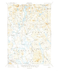
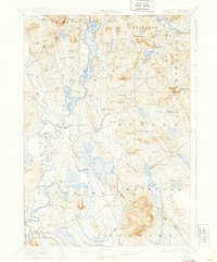
1911 Map of Fryeburg
USGS Topo · Published 1947About this map
Fryeburg and the surrounding townships of Lovell, Stoneham, and Sweden are defined by the intricate waterways of the Saco River and the expansive Upper Bay and Lower Bay of Kezar Lake. In the southern portion of the map, the Maine Central Railroad (White Mountains Line) skirts the village of Fryeburg, passing the local Fairgrounds and the Battle Monument near Jockey Cap. The landscape is a patchwork of small agrarian settlements and scattered rural schoolhouses, such as the Menotomy School and Foxborg School, which served the family farms tucked between numerous hills like Starks Mtn and Sabattus Mtn.
Find a feature on this map
161 named features on this map. Tap any name to fly to it.
Don’t see what you’re looking for? This feature index may not catch every label — zoom into the map to look around manually.
Map Details
Editions of this 1911 Fryeburg Map
6 editions found
Other maps of this area

1893 · Gorham
USGS Topo · 1:62,500

1894 · North Conway
USGS Topo · 1:62,500

1896 · Norway
USGS Topo · 1:62,500

1896 · Sebago
USGS Topo · 1:62,500

1896 · North Conway
USGS Topo · 1:62,500

1896 · Gorham
USGS Topo · 1:62,500

1909 · Fryeburg
USGS Topo · 1:62,500

1910 · Kezar Falls
USGS Topo · 1:48,000

1911 · Fryeburg
USGS Topo · 1:62,500

1911 · Kezar Falls
USGS Topo · 1:62,500