
1967 Map of Ft. George Butte NW
USGS Topo · Published 1969About this map
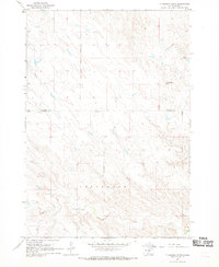
Antelope Creek and Timber Creek carve through this high plains landscape along the Stanley and Lyman County line during the late 1960s. The region is defined by its wide, drainage-cut plateaus, where water sources like the Flowing Well were vital to the local ranching economy. Rural education is anchored by the Cedar Valley Sch, a solitary landmark in an area characterized by sparse settlement and section-line roads. To the south, the topography descends toward the valley of Cedar Creek, including its South Branch, near the Cedar Creek Recreation Area. This survey provides a precise look at the land use and hydrology of the Missouri River hinterlands before significant modern infrastructure altered the more traditional rural patterns of central South Dakota.
Find a feature on this map
10 named features on this map. Tap any name to fly to it.
Don’t see what you’re looking for? This feature index may not catch every label — zoom into the map to look around manually.
Map Details
Editions of this 1967 Ft. George Butte NW Map
This is the sole edition of this map. No revisions or reprints were ever made.
Other maps of this area

1924 · Pierre
USGS Topo · 1:62,500

1934 · Canning
USGS Topo · 1:48,000

1937 · Canning
USGS Topo · 1:62,500

1954 · Pierre
USGS Topo · 1:250,000

1958 · Pierre
USGS Topo · 1:250,000

1966 · Ft. George Butte SE
USGS Topo · 1:24,000

1967 · Ft. George Butte SW
USGS Topo · 1:24,000
1967 · Ft. George Butte
USGS Topo · 1:24,000

1972 · Pierre 3 SE
USGS Topo · 1:24,000
1972 · Pierre 3 NE
USGS Topo · 1:24,000