
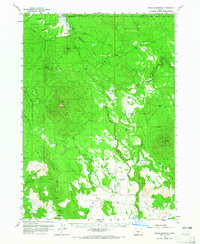
1960 Map of Fuego Mountain
USGS Topo · Published 1962About this map
Fuego Mountain rises as the central landmark in this high-elevation landscape of the Winema National Forest and Fremont National Forest during the early 1960s. The map documents a territory defined by seasonal grazing and water management, where named meadows such as Wildhorse Meadow and Teddy Powers Meadow indicate historical range use. The Yamsay Ranch and the nearby Yamsay Guard Sta represent the few outposts of human infrastructure in an area dominated by the headwaters of major waterways, including the Williamson River, Sycan River, and the Sprague River valley. A complex network of springs, such as Coyote Spring and Torrent Spring, supports the livestock and wildlife across Silver Dollar Flat and the High Tableland. This survey also preserves the alignment of the Old Indian Res Bdy and the Indian Reservation Bdy, illustrating the shifting administrative boundaries of the Klamath Basin.
Find a feature on this map
43 named features on this map. Tap any name to fly to it.
Don’t see what you’re looking for? This feature index may not catch every label — zoom into the map to look around manually.
Map Details
Editions of this 1960 Fuego Mountain Map
2 editions found
Other maps of this area

1889 · Klamath
USGS Topo · 1:250,000

1894 · Klamath
USGS Topo · 1:250,000

1955 · Klamath Falls
USGS Topo · 1:250,000

1956 · Calimus Butte
USGS Topo · 1:62,500

1957 · Klamath Marsh
USGS Topo · 1:62,500

1957 · Swan Lake
USGS Topo · 1:62,500

1958 · Klamath Falls
USGS Topo · 1:250,000

1960 · Riverbed Butte
USGS Topo · 1:62,500

1960 · Sycan Marsh
USGS Topo · 1:62,500

1960 · Bly
USGS Topo · 1:62,500