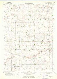
1970 Map of Fulda SW
USGS Topo · Published 1972About this map
Jack Creek meanders through the heart of this prairie landscape, defining a rural Nobles County terrain dominated by a systematic network of drainage projects like Judicial Ditch No 20 and Judicial Ditch No 80. This 1970 field check reveals a community centered on agricultural infrastructure and small rural hubs, notably at Pfingsten, which sits near the Immanuel Ch. The northeast corner is clipped by the Chicago Milwaukee St Paul and Pacific railroad, illustrating the transport links that once served these townships. In the south, the Groth State Wildlife Management Area provides a break from the gridded section lines. Genealogists and local historians will find value in the precise location of the Seward Cem and the various gravel pits that once supported local road building and industry across Bloom and Seward townships.
Find a feature on this map
17 named features on this map. Tap any name to fly to it.
Don’t see what you’re looking for? This feature index may not catch every label — zoom into the map to look around manually.
Map Details
Editions of this 1970 Fulda SW Map
This is the sole edition of this map. No revisions or reprints were ever made.
Other maps of this area

1954 · Fairmont
USGS Topo · 1:250,000

1958 · Fairmont
USGS Topo · 1:250,000

1960 · Reading
USGS Topo · 1:24,000

1960 · Worthington North
USGS Topo · 1:24,000

1967 · Slayton
USGS Topo · 1:24,000

1967 · Wilmont
USGS Topo · 1:24,000

1967 · Adrian NE
USGS Topo · 1:24,000

1970 · Fulda
USGS Topo · 1:24,000
1970 · Lime Creek
USGS Topo · 1:24,000
1970 · Avoca
USGS Topo · 1:24,000