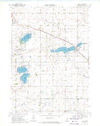
1970 Map of Avoca
USGS Topo · Published 1972About this map
Avoca and the surrounding prairie of Murray County appear here during the early 1970s, defined by a landscape of glacial lakes and critical rail corridors. The Chicago and North Western railway cuts diagonally through the sheet, serving the grain-rich regions near Lime Lake and the Avoca State Wildlife Management Area. To the west, the expansion of Slayton is visible, bordered by Restland Memory Gardens and the Slayton Wildlife Management Area, which encompasses the waters of Big Slough.
Find a feature on this map
26 named features on this map. Tap any name to fly to it.
Don’t see what you’re looking for? This feature index may not catch every label — zoom into the map to look around manually.
Map Details
Editions of this 1970 Avoca Map
This is the sole edition of this map. No revisions or reprints were ever made.
Other maps of this area

1953 · New Ulm
USGS Topo · 1:250,000

1954 · Fairmont
USGS Topo · 1:250,000

1957 · New Ulm
USGS Topo · 1:250,000

1958 · New Ulm
USGS Topo · 1:250,000

1958 · Fairmont
USGS Topo · 1:250,000

1967 · New Ulm
USGS Topo · 1:250,000

1967 · Slayton
USGS Topo · 1:24,000

1967 · Wilmont
USGS Topo · 1:24,000

1967 · Hadley
USGS Topo · 1:24,000

1967 · Dovray
USGS Topo · 1:24,000