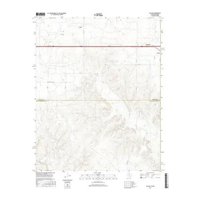
2016 Map of Fuller
USGS Topo · Published 2016About this map
Texola sits along the far eastern edge of the Texas Panhandle, positioned just west of the Oklahoma state line in a landscape defined by ranch roads and intermittent drainages. This high-plains topography is marked by the course of N Elm Cr and Lost Cr, which carve through the terrain as it transitions southward. The map illustrates a rural settlement pattern where traditional crossroads like Fuller and Benonine anchor a network of local routes, including Co RD 26 and Co RD 58. The transition between Wheeler and Collingsworth counties is noted by the Wheeler Co Collingsworth Co line, reflecting the political divisions of this borderland. The placement of the Co Rd Shopping Center label suggests a localized hub of activity amidst the expansive rangelands and seasonal creek beds like Cypress Cr.
Find a feature on this map
19 named features on this map. Tap any name to fly to it.
Don’t see what you’re looking for? This feature index may not catch every label — zoom into the map to look around manually.
Map Details
Editions of this 2016 Fuller Map
This is the sole edition of this map. No revisions or reprints were ever made.
Other maps of this area

1954 · Amarillo
USGS Topo · 1:250,000

1955 · Clinton
USGS Topo · 1:250,000

1957 · Clinton
USGS Topo · 1:250,000

1958 · Amarillo
USGS Topo · 1:250,000

1960 · Sweetwater
USGS Topo · 1:62,500

1961 · Erick
USGS Topo · 1:62,500

1962 · Twitty
USGS Topo · 1:24,000

1962 · Kelton SE
USGS Topo · 1:24,000

1963 · Fulller
USGS Topo · 1:24,000

1963 · Shamrock East
USGS Topo · 1:24,000