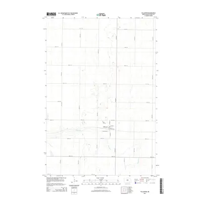
2014 Map of Fullerton
USGS Topo · Published 2014About this map
Fullerton serves as the primary settlement on this Dickey County prairie, situated along the winding course of the Maple River. The town's grid is clearly defined by residential streets like Minneapolis Ave, Southworth Ave, and S Monroe St. Just north of the main village, the Maple View Cem provides a specific point of interest for genealogists and local historians tracking the early families of the area. The surrounding landscape is characterized by a precise network of rural sections, with roads like 86th St SE and 94th Ave SE defining the agricultural layout. This map illustrates the intersection of small-town North Dakota life with the natural drainage patterns of the river, preserving the spatial arrangement of the community and its outlying farmsteads.
Find a feature on this map
23 named features on this map. Tap any name to fly to it.
Don’t see what you’re looking for? This feature index may not catch every label — zoom into the map to look around manually.
Map Details
Editions of this 2014 Fullerton Map
This is the sole edition of this map. No revisions or reprints were ever made.
Other maps of this area

1894 · Monango
USGS Topo · 1:62,500

1894 · La Moure
USGS Topo · 1:62,500

1894 · Fullerton
USGS Topo · 1:62,500

1895 · Lamoure
USGS Topo · 1:125,000

1896 · Edgeley
USGS Topo · 1:125,000

1918 · La Moure
USGS Topo · 1:125,000

1925 · Edgeley
USGS Topo · 1:125,000

1953 · Jamestown
USGS Topo · 1:250,000

1955 · Fullerton NE
USGS Topo · 1:24,000
1955 · Fullerton SE
USGS Topo · 1:24,000