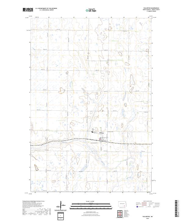
2024 Map of Fullerton
USGS Topo · Published 2024About this map
The Maple River meanders through this portion of Dickey County, defining a landscape marked by the small settlement of Fullerton and the residential area of Maple View. This survey captures a rural North Dakota community organized around a strict grid of section lines and county roads, such as Dickey Co Rd 8 and 87th St SE. Just north of the town center, Saint Patricks Cem serves as a significant landmark for those tracing local family histories. The southern reaches of the map are dominated by the Dickey County Waterfowl Production Area, reflecting the region's importance to conservation and its characteristic prairie pothole topography. The map illustrates how local life remains closely tied to the river valley, with streets like Minneapolis Ave and Southworth Ave anchoring the small-town core amidst the surrounding agricultural expanse.
Find a feature on this map
31 named features on this map. Tap any name to fly to it.
Don’t see what you’re looking for? This feature index may not catch every label — zoom into the map to look around manually.
Map Details
Editions of this 2024 Fullerton Map
This is the sole edition of this map. No revisions or reprints were ever made.
Other maps of this area

1894 · Monango
USGS Topo · 1:62,500

1894 · La Moure
USGS Topo · 1:62,500

1894 · Fullerton
USGS Topo · 1:62,500

1895 · Lamoure
USGS Topo · 1:125,000

1896 · Edgeley
USGS Topo · 1:125,000

1918 · La Moure
USGS Topo · 1:125,000

1925 · Edgeley
USGS Topo · 1:125,000

1953 · Jamestown
USGS Topo · 1:250,000

1955 · Fullerton NE
USGS Topo · 1:24,000
1955 · Fullerton SE
USGS Topo · 1:24,000