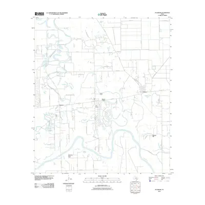
2010 Map of Fulshear
USGS Topo · Published 2010About this map
The Brazos River meanders sharply across this 2010 landscape, carving deep oxbows and loops through Fort Bend County. This modern survey captures a period of transition, where established rural communities like Simonton and Fulshear are seen alongside growing residential developments such as Weston Lakes. The terrain is defined by a network of drainage systems including Bessies Creek and Brookshire Creek, which fed into the larger river valley long before suburban expansion reached this far west of Houston. For local historians and genealogists, the map identifies specific cultural landmarks like the Little Prayer Cemetery and small airfields including Fendley Airport and White Wing Ranch Airport. The layout of roads like FM 1093 Rd and FM 359 Rd reveals the persistent skeleton of older farm-to-market routes that continue to shape the region's connectivity.
Find a feature on this map
59 named features on this map. Tap any name to fly to it.
Don’t see what you’re looking for? This feature index may not catch every label — zoom into the map to look around manually.
Map Details
Editions of this 2010 Fulshear Map
This is the sole edition of this map. No revisions or reprints were ever made.
Other maps of this area

1915 · Katy
USGS Topo · 1:24,000

1950 · Houston
USGS Topo · 1:250,000

1953 · Seguin
USGS Topo · 1:250,000

1955 · Brookshire
USGS Topo · 1:62,500

1955 · Richmond
USGS Topo · 1:62,500

1956 · Sealy
USGS Topo · 1:62,500

1956 · Wallis
USGS Topo · 1:62,500

1956 · Houston
USGS Topo · 1:250,000

1958 · Seguin
USGS Topo · 1:250,000

1960 · Wallis
USGS Topo · 1:24,000