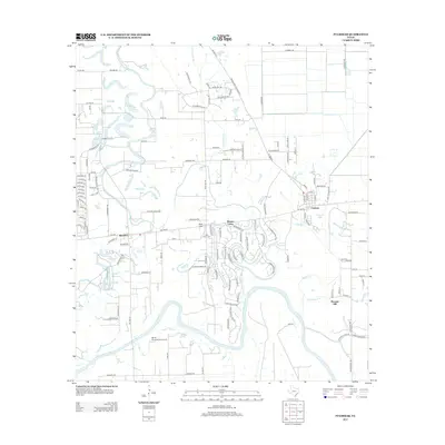
2013 Map of Fulshear
USGS Topo · Published 2013About this map
The Brazos River winds through the southern portion of this region, shaping the landscape near the growing settlements of Fulshear and Simonton. The map documents a period of suburban expansion and residential development, particularly evident in the winding streets of Weston Lakes and the subdivisions branching off FM 1093. Historically significant landmarks like the Little Prayer Cem and Pool Hill provide anchors to the area's older rural character, while the White Wing Ranch Airport highlights more modern land uses.
Find a feature on this map
122 named features on this map. Tap any name to fly to it.
Don’t see what you’re looking for? This feature index may not catch every label — zoom into the map to look around manually.
Map Details
Editions of this 2013 Fulshear Map
This is the sole edition of this map. No revisions or reprints were ever made.
Other maps of this area

1915 · Katy
USGS Topo · 1:24,000

1950 · Houston
USGS Topo · 1:250,000

1953 · Seguin
USGS Topo · 1:250,000

1955 · Brookshire
USGS Topo · 1:62,500

1955 · Richmond
USGS Topo · 1:62,500

1956 · Sealy
USGS Topo · 1:62,500

1956 · Wallis
USGS Topo · 1:62,500

1956 · Houston
USGS Topo · 1:250,000

1958 · Seguin
USGS Topo · 1:250,000

1960 · Wallis
USGS Topo · 1:24,000